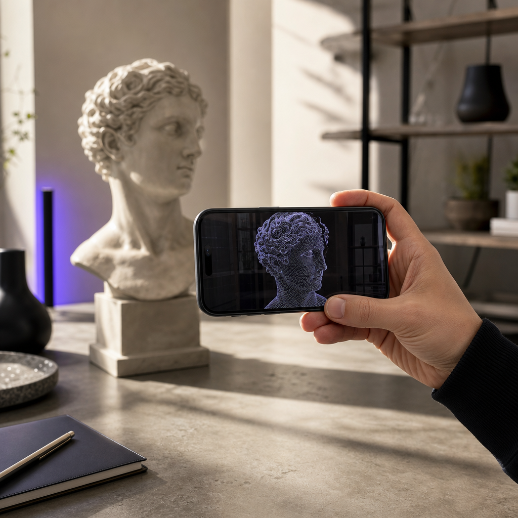
The moment you unlock the LiDAR sensor on an iPhone 12 Pro or newer, your phone stops being a camera and starts behaving like a spatial instrument. An iphone lidar scanner captures real depth — not a flat image guessed from pixels, but measured distance to every surface in front of you. With Voxelio, that raw depth becomes something you can actually use: textured meshes, colored point clouds, and camera-pose data exported straight from the device. We built Voxelio to close the gap between the sensor Apple already put in your pocket and the professional 3D pipelines that used to require a dedicated laser scanner.
This is a working tool, not a novelty. Architects document as-built conditions, engineers pull reference geometry into CAD, sellers replace flat product photos with interactive 3D, and researchers collect synchronized video and trajectory data for computer-vision work. Everything runs on-device, with no cloud queue and no subscription. Below we explain how the hardware and our reconstruction stack work together, and how each of these workflows maps to a specific capture mode and export.
Table of contents
- How iPhone LiDAR Turns Your Phone Into a Pro 3D Scanner
- Voxelio: Four Capture Modes, Real Outputs, On-Device
- Workflows for Architects, Designers, and Real Estate
- From Scan to CAD, AR, and 3D Printing
- Voxelio for E-Commerce, CV Research, and Robotics
- Getting Started With Voxelio
- Frequently Asked Questions
How iPhone LiDAR Turns Your Phone Into a Pro 3D Scanner
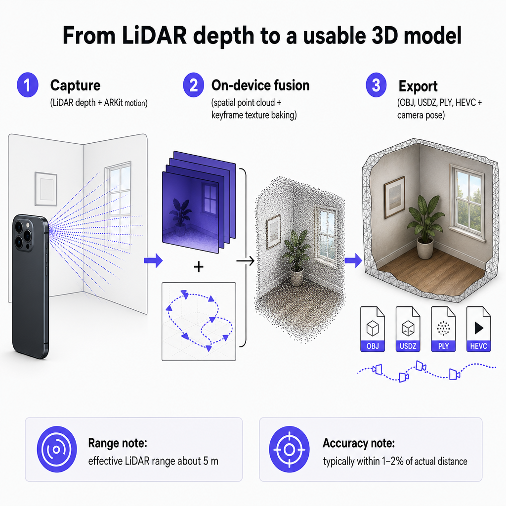
The LiDAR sensor on iPhone Pro models emits light and measures the time it takes to bounce back, producing a depth map of the scene many times per second. Apple's ARKit fuses that depth stream with the phone's motion tracking, so as you move around a room or an object the device knows where it is in space and how far away each surface sits. That combination — measured depth plus tracked position — is what makes reliable 3D reconstruction possible on a consumer phone.
The accuracy is good enough for real work. Under normal conditions, iPhone LiDAR measurements typically fall within 1–2% of the actual distance, with an effective range of roughly five meters. Those numbers frame realistic expectations: this is precise, dependable capture for rooms, objects, installations, and mid-size components, rather than long-range terrain mapping. Scientific evaluation of the iPhone 12 Pro LiDAR sensor has already described it as a cost-effective and time-efficient alternative to traditional terrestrial laser scanning for small- to medium-scale work, which is exactly the scale most of our users operate at.
What the sensor delivers on its own is still raw. It doesn't hand you a clean, textured, exportable model — it hands you depth frames and motion data. Turning that into geometry a professional can open in their toolchain is the reconstruction problem, and it's where an app does the heavy lifting. If you want the full sensor primer before going further, our explainer on what the LiDAR scanner in your iPhone can actually do walks through range, accuracy, and everyday versus professional use.
Voxelio: Four Capture Modes, Real Outputs, On-Device
Voxelio is our iPhone LiDAR 3D scanner app, built around ARKit mesh reconstruction, spatial point cloud fusion, and keyframe texture baking. Those three techniques do distinct jobs: reconstruction turns depth into surfaces, fusion combines LiDAR returns and device motion into one coherent dataset, and texture baking wraps camera frames onto the geometry so the result looks like the real object, not a gray shell. All of it happens directly on your iPhone. Nothing uploads, nothing waits in a processing queue, and the data never leaves your device.
We expose this through four capture modes, each aimed at a different kind of result:
- Mesh produces textured 3D surface models — the right choice for architecture, interiors, and product visualization where appearance matters.
- Point Cloud produces dense, colored 3D point sets, better suited to analytic geometry for CAD, BIM, and scientific work.
- Pose+Video records HEVC video alongside frame-accurate camera poses, giving you a synchronized trajectory for computer-vision pipelines.
- MultiCam handles multi-camera or multi-pass capture for richer texture detail and fuller angular coverage.
The outputs are equally concrete. Mesh scans export as textured OBJ or USDZ, ready for DCC tools, AR viewers, and product pages. Point Cloud scans export as colored PLY for CAD, BIM, and research workflows. Pose+Video hands you HEVC footage with camera pose data attached, which is the format NeRF, SLAM, and photogrammetry pipelines expect. One capture session, multiple professional-grade formats.
Two positioning points matter for anyone weighing the cost of spatial capture. First, Voxelio is free to download with no subscription — we deliberately removed the recurring paywall that many professional scanning apps put in front of CAD export and commercial features. Second, staying entirely on-device is a feature in its own right: it means privacy, offline capability on sites with no connectivity, and no data-handling questions when you scan a client's space. Our companion piece on turning your Pro camera into a 3D capture tool covers the sensor-to-app relationship in more depth if you're evaluating the fundamentals.
Workflows for Architects, Designers, and Real Estate
Spatial documentation is where iPhone LiDAR has already earned professional trust. iPhone Pro models are used for fast, dimensioned floor-plan capture and 3D room scans of commercial interiors, feeding pre-construction site surveys, existing-conditions capture before renovation, and inspection workflows. That acceptance isn't hypothetical — it reflects how design and building teams work today, and it's exactly the market Voxelio serves.
A typical session looks like this. You open Voxelio, choose Mesh mode for a visual as-built model or Point Cloud mode when you need clean geometry for measurement, and walk the space while staying within LiDAR's effective range. The app fuses the depth and motion data into a single spatial dataset, reconstructs it, and lets you export a textured OBJ or USDZ for presentation and AR, or a colored PLY that drops into CAD and BIM environments. Because processing is on-device, a designer can capture a unit, an interior manager can document a retail floor, and a real-estate professional can produce a spatial listing asset all without an internet connection.
LiDAR's relevance to this segment goes beyond individual rooms. The technology underpins indoor mapping generally, where room scans generate floor plans and support navigation and space planning. For a building-scale walkthrough — capturing a structure and exporting a model your team can actually build on — our guide to creating a building 3D model with your iPhone LiDAR scanner lays out the full room-by-room approach.
One honest boundary belongs in every professional conversation: these scans are fast, practical documentation and design inputs. They complement formal surveys rather than replacing licensed surveyor outputs, and larger or highly regulated jobs still call for traditional terrestrial laser scanning. Positioning Voxelio as the fast capture layer — not the legal record — keeps expectations aligned with what the hardware genuinely does well.
From Scan to CAD, AR, and 3D Printing
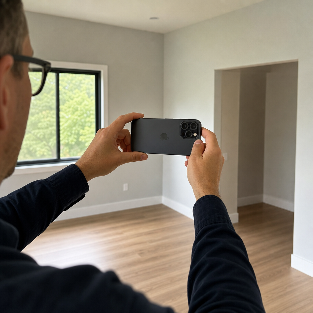
For engineers, makers, and fabrication work, the value of an iphone lidar scanner is measured in usable geometry. Voxelio's Point Cloud and Mesh modes produce reference geometry you can bring into a CAD or CAM workflow — capturing a part, an installation, or a prototype so you can measure it, redesign around it, or reverse-engineer an existing object. The LiDAR sensor's 1–2% distance accuracy and roughly five-meter range make it a sound fit for small rooms, machine installations, and mid-size components, the scale where most reverse-engineering and fitting problems live.
The capture-to-CAD path is already established across the industry. A growing number of iPhone and iPad LiDAR apps generate CAD-ready data, and mobile LiDAR output flows into tools such as AutoCAD, streamlining what used to be a manual survey-and-redraw step. Voxelio fits this pattern by exporting colored PLY for point-cloud-based CAD and BIM work, and textured OBJ or USDZ when you need a surface model. Because the sensor's evaluation history includes serious survey applications, treating these outputs as design inputs is defensible rather than aspirational.
3D printing and hobbyist fabrication follow the same logic at a smaller scale. Scan a real object in Mesh mode, export it as OBJ, and you have a fabrication reference you can clean up and print — no dedicated scanner, no studio setup. The free, no-subscription model makes this kind of low-friction experimentation genuinely low risk: you can capture, export, test the fit in your slicer or CAD tool, and iterate without a recurring cost hanging over each scan.
A quick word on formats and precision. Voxelio's confirmed exports are OBJ, USDZ, and PLY meshes and clouds, plus HEVC video with pose data. We describe centimeter-level precision as our reconstruction target built on ARKit, spatial fusion, and texture baking; for any job with strict tolerance requirements, validate a scan against a known dimension before committing the geometry to production. That verification habit is standard practice with any capture device and keeps your downstream work honest.
Voxelio for E-Commerce, CV Research, and Robotics
Sellers who replace flat product photos with 3D models get an immediate, tangible upgrade in how buyers experience a listing. Voxelio's Mesh mode plus keyframe texture baking yields ready-to-use textured OBJ and USDZ files — the formats web viewers and AR product experiences consume directly. Smartphone LiDAR is already recognized for enabling automatic 3D model generation and AR visualization, so a seller can orbit a product, export a USDZ, and drop an interactive model into a storefront or a native app without a photography studio or a dedicated scanner. Free download and no subscription mean testing 3D on a handful of SKUs costs nothing but time.
Computer-vision and robotics researchers have a different need: controlled datasets. Pose+Video mode records HEVC footage with frame-accurate camera poses, and MultiCam adds multi-angle coverage, which turns the iPhone into a compact research sensor rig. That synchronized trajectory-and-imagery output is precisely what NeRF reconstruction, SLAM mapping, and photogrammetry pipelines are built to ingest — normally the province of a purpose-built capture setup, now available from a phone you can carry into any environment.
The on-device architecture is more than a convenience here. When you're capturing in a lab, a sensitive facility, or a client site, keeping all processing on the device means the raw video and pose data never traverse a cloud service. For teams working under institutional privacy or ethics expectations, that boundary is often the difference between a workable tool and a non-starter. iPhone LiDAR is worth adopting for quick 3D scans, room capture, AR previews, and dataset collection; it is not a drop-in replacement for every industrial robotics or UAV sensor, and we position Voxelio squarely inside the range where consumer LiDAR genuinely delivers.
Getting Started With Voxelio
Getting from download to your first usable export is a short path. The steps below work for any of our audiences; only the mode and export format change with your goal.
- Confirm your device. Voxelio needs an iPhone 12 Pro or later — the Pro models that carry the LiDAR sensor. Android support is on our roadmap, so today's workflow is iPhone-based.
- Download the app and define your objective. Decide up front whether you're doing a room survey, a product model, a part capture, or a CV dataset. That single decision drives everything after it.
- Choose the capture mode. Mesh for visual models in architecture, interiors, and products; Point Cloud for analytic geometry in engineering and CAD/BIM; Pose+Video for CV, SLAM, and NeRF datasets; MultiCam when you need richer texture or fuller coverage.
- Capture the scene. Move steadily around the object or through the space, keeping surfaces within LiDAR's effective range of about five meters for reliable depth. Even, unhurried motion gives the fusion step the cleanest data to work with.
- Process and export on-device. Voxelio reconstructs and fuses the scan right on the phone, then exports the format you need — OBJ or USDZ for design, AR, and product visualization; PLY for CAD, BIM, and scientific work; HEVC plus camera poses for research pipelines.
- Integrate downstream. Bring the file into your CAD, BIM, DCC, or CV toolchain, or straight into a slicer for 3D printing. Validate against a known dimension the first time so you calibrate your expectations for the job at hand.
The practical way to learn the tool is to run one real scan of something on your desk or in the room you're in, export it, and open it in the software you already use. That single loop tells you more about fit than any spec sheet.
Frequently Asked Questions
How accurate is iPhone LiDAR for room scanning?
Under normal conditions, iPhone LiDAR measurements typically fall within 1–2% of the actual distance, with an effective range of about five meters. For rooms, objects, and mid-size installations that is dependable, usable accuracy. We build Voxelio's reconstruction to target centimeter-level precision from that sensor data, and for tolerance-critical work we recommend validating a scan against a known dimension before you rely on the geometry.
Which iPhone models work with Voxelio?
Voxelio runs on iPhone 12 Pro and later — the Pro models equipped with the LiDAR sensor. The LiDAR hardware is what makes measured depth capture possible, so a non-Pro iPhone won't drive the same reconstruction pipeline. Android support is planned for the future; today the workflow is iPhone-based.
Can Voxelio's scans be used in CAD and BIM software?
Yes. Voxelio exports colored PLY point clouds for CAD, BIM, and scientific workflows, and textured OBJ or USDZ meshes for design, AR, and visualization tools. Mobile LiDAR data already flows into CAD environments such as AutoCAD across the industry, and our export formats are chosen to fit those established pipelines.
Is my data processed in the cloud or only on my phone?
Entirely on your phone. Voxelio performs mesh reconstruction, spatial point cloud fusion, and keyframe texture baking on-device using ARKit and the LiDAR sensor. There is no upload and no cloud queue, which means faster turnaround, offline capability on disconnected sites, and no client or research data leaving the device.
Do I need a subscription to use Voxelio?
No. Voxelio is free to download with no subscription. We deliberately kept professional-grade capture and export out from behind a recurring paywall, so you can capture, export, and integrate scans without a per-month cost — a clear difference from subscription-heavy scanning apps.
Can these scans replace a professional land survey?
Treat Voxelio scans as fast, practical documentation and design inputs that complement formal surveys, not as automatic substitutes for licensed surveyor outputs. None of the available evidence establishes iPhone LiDAR scans as universally accepted for boundary surveys or statutory documentation, and larger or regulated jobs still call for traditional terrestrial laser scanning. Confirm what your local regulations permit for any official use.