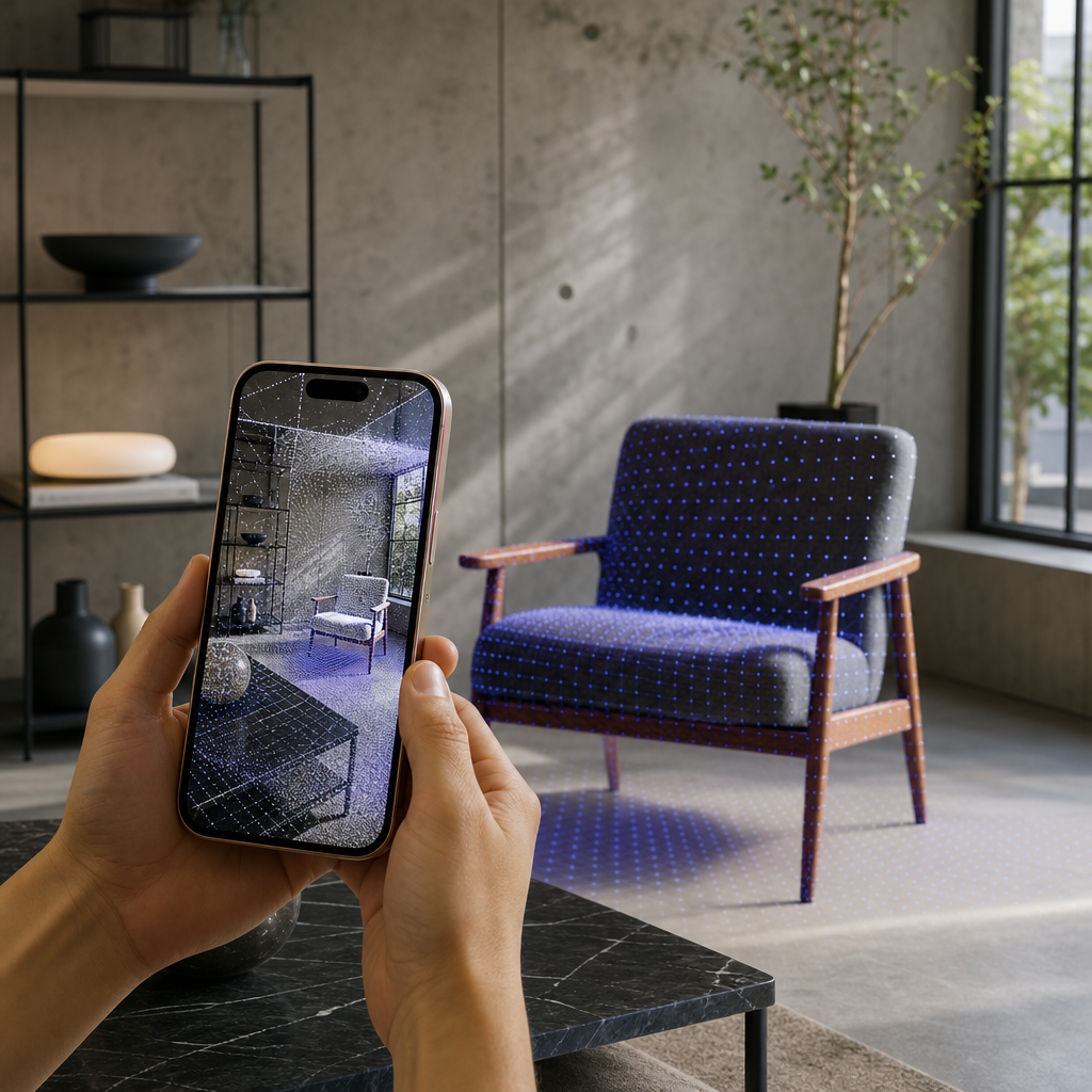
An iPhone LiDAR scanner is the built-in LiDAR sensor on Pro-model iPhones combined with a capture app like Voxelio, turning the phone into a centimeter-level 3D capture tool that records real spaces and objects as textured meshes, colored point clouds, and camera pose data — reconstructed entirely on-device. If your iPhone has a LiDAR sensor, you already own most of a working 3D scanner.
The lidar scanner iphone workflow starts with hardware Apple ships only on Pro models, and finishes with standard 3D files you can pull straight into CAD, design, e-commerce, or research tools. This guide explains how that pipeline actually works, what each capture mode produces, and how architects, engineers, sellers, and researchers can judge whether it fits their existing workflow.
Table of contents
- What an iPhone LiDAR scanner is and how it works
- The capture modes and what separates them
- How iPhone LiDAR differs from photogrammetry and laser scanners
- Why on-device LiDAR matters for your work
- What to weigh before you rely on it
- Frequently asked questions
What an iPhone LiDAR scanner is and how it works
LiDAR stands for Light Detection and Ranging. As an active remote-sensing method, it emits laser pulses and measures the time each pulse takes to strike a surface and return to the sensor; that time-of-flight, combined with the beam angle, is used to compute a precise 3D location for every return. Run that thousands of times per second and you get a dense point cloud — a collection of x, y, z coordinates describing the surfaces in front of the sensor. The USGS explanation of what LiDAR is and NOAA's Lidar 101 primer describe this same time-of-flight principle that the miniaturized sensor in a Pro iPhone uses at close range.
Apple's software layer takes over from there. On a device with a LiDAR Scanner, ARKit uses that sensor to create a polygonal model of the physical environment, converting depth information into a series of vertices that connect to form a mesh, partitioned into multiple mesh anchors placed in real-world coordinates. Apple's own ARKit documentation on visualizing a reconstructed scene confirms this scene-reconstruction behavior and states it requires a device with a LiDAR Scanner.
Voxelio builds directly on that engine. In our pipeline, LiDAR depth feeds ARKit mesh reconstruction and raw point samples, our own spatial fusion combines those samples over time, and keyframe texture baking maps selected RGB camera frames onto the geometry to produce a textured surface rather than bare polygons. The result is exported on-device as textured OBJ and USDZ meshes, colored PLY point clouds, or video with frame-accurate camera poses. Nothing is uploaded to a server for processing, so you capture and export in the field without a network connection. If you want the sensor-level detail behind this, our companion explainer on how your iPhone captures the real world in 3D goes deeper on the depth pipeline.

The capture modes and what separates them
A single scan can serve very different downstream jobs, so the meaningful distinction is not "which mode is best" but which underlying data each mode preserves: complete geometry, raw spatial samples, or camera trajectory. Voxelio exposes four modes, each built around ARKit mesh reconstruction and our custom spatial fusion.
| Capture mode | Output format | What it preserves | Typical use |
|---|---|---|---|
| Mesh | Textured OBJ / USDZ | Solid, textured surface geometry | Room and object visualization, client-facing models |
| Point Cloud | Colored PLY | Raw spatial samples, LiDAR's native form | Re-meshing, CAD/BIM analysis, custom pipelines |
| Pose+Video | HEVC video + camera poses | Frame-accurate camera trajectory plus imagery | NeRF, SLAM, photogrammetry research |
| MultiCam | Multi-viewpoint capture | Broader coverage of occluded scenes | Complex or partially hidden scenes |
Mesh mode gives you a watertight-feeling textured model straight away, which is why it suits people who need to show geometry rather than process it. Point Cloud mode hands back the data in its native form — the same point-cloud representation LiDAR produces at any scale — so it is the honest starting point when you plan to re-mesh or analyze the geometry yourself. Pose+Video is the outlier: it does not try to hand you finished geometry at all. It records HEVC video alongside frame-accurate camera poses, giving appearance-based methods the accurate camera trajectory and scale reference they depend on. MultiCam adds coverage by capturing from multiple viewpoints, which helps when a single sweep leaves blind spots behind furniture, machinery, or intricate objects.
Choosing between a point cloud and a finished mesh is a decision in its own right, and the conversion between them has real trade-offs; our guide on converting point clouds into usable meshes covers what changes when you cross that boundary.
How iPhone LiDAR differs from photogrammetry and laser scanners
iPhone LiDAR sits between two neighbors people often confuse it with. Photogrammetry reconstructs geometry purely from overlapping photographs, inferring depth from parallax; it can produce beautiful detail but struggles with plain surfaces, poor lighting, and reliable scale. LiDAR is an active sensor — it supplies its own light and measures distance directly — so it captures depth and true scale even on featureless walls or in dim rooms, without needing texture in the scene to work from.
At the other end sit dedicated survey-grade laser scanners, which USGS describes as instruments for obtaining highly accurate and precise three-dimensional measurements of surface locations. Those systems are built and calibrated for surveying tolerances. The iPhone sensor uses the same time-of-flight physics but in a phone-sized package tuned for room-scale and object-scale capture rather than long-range terrain mapping.
Voxelio actually blends the strengths of the first two: LiDAR provides the reliable depth and scale backbone, while keyframe texture baking layers real camera imagery on top for appearance. Pose+Video takes this further by exporting the camera track that photogrammetry and NeRF pipelines need. Where a given capture belongs in the wider scanning landscape is exactly what our beginner's guide to 3D scanners is built to situate.
Why on-device LiDAR matters for your work
The reason this matters is that a phone you already carry can now feed the same pipelines you already use, and each audience gets a different payoff from the same sensor.
- Architects and interior designers capture room meshes with texture for layout studies and client communication, skipping a separate site-measurement trip.
- Real estate professionals produce fast, accurate space scans and USDZ models for interactive listings that go beyond flat photos.
- Engineers and makers export OBJ geometry as a dimensional reference for CAD and fabrication work, or a point cloud when they want raw samples to build from.
- E-commerce and marketplace sellers replace product photos with interactive USDZ models — a natural fit because USDZ is a native Apple 3D format widely supported in AR and product viewers.
- CV and robotics researchers use Pose+Video to feed NeRF training, SLAM, or photogrammetry, where LiDAR gives a dependable depth and scale reference alongside the imagery.
Two differentiators cut across all of these. First, reconstruction and export happen entirely on-device, so captured spaces stay private to your phone unless you choose to export or share them — a meaningful point when you scan client sites, private homes, or unreleased products. Second, working offline in the field means no upload wait and no dependence on connectivity on a job site.
What to weigh before you rely on it
This is a judgment call, not a checklist, and a few criteria decide whether iPhone LiDAR fits a given job.
Device support is binary. ARKit scene reconstruction requires the built-in LiDAR Scanner, which Apple includes only on Pro models — iPhone 12 Pro and later — and compatible iPad Pro devices. Apple's documentation on scene-reconstruction support?changes=__1_6_8&language=objc) exposes this as a device capability check. Standard, non-Pro iPhones lack the sensor and cannot run LiDAR capture. Android support is planned but not yet available, so this is currently an iOS, Pro-hardware tool.
Match the output to the downstream tool. Decide first what your next software expects: solid surfaces (mesh), raw samples (point cloud), or a camera track (pose+video). Capturing the wrong representation means extra conversion later, so let the tool at the end of your pipeline drive the choice.
Set realistic accuracy expectations. We describe Voxelio as delivering centimeter-level precision on LiDAR-equipped iPhones, which is well suited to conceptual design, visualization, e-commerce models, and fabrication references. It is not positioned as a replacement for survey-grade instruments. Formal survey, legal boundary, or regulated engineering sign-off work has context-specific tolerances and may still require dedicated equipment and licensed practice, so verify project requirements before treating any scan as authoritative.
Scene size and complexity change results. Large, reflective, or heavily occluded scenes are where a single pass falls short — this is exactly the gap MultiCam and careful coverage are meant to close.
With those criteria clear, the practical next move is to decide which capture mode and export format your existing workflow needs, then let the phone become the capture layer that feeds it. For sensor mechanics, revisit our iPhone LiDAR capture explainer; for turning raw scans into finished models, our point cloud to mesh guide is the logical next read.
Frequently asked questions
Which iPhones can run a LiDAR scanner app?
Only Pro models with the built-in LiDAR Scanner — iPhone 12 Pro and later — plus compatible iPad Pro devices support ARKit scene reconstruction. Standard, non-Pro iPhones lack the sensor and cannot perform LiDAR capture.
Is iPhone LiDAR accurate enough for professional work?
It is generally precise enough for design, visualization, e-commerce models, and fabrication references, and Voxelio targets centimeter-level precision. Formal survey or regulated engineering work has context-specific tolerances and may still require dedicated instruments.
What is the difference between a point cloud and a mesh?
A point cloud is the raw set of x, y, z sample points LiDAR produces. A mesh connects those points into a continuous polygonal surface. Voxelio can export either, so you choose based on whether your next tool needs raw samples or solid geometry.
Does Voxelio send my scans to the cloud?
No. Reconstruction and export run entirely on-device, so captured spaces and objects stay private to your phone unless you choose to export or share them, and you can work with no network connection.
How is LiDAR different from photogrammetry?
LiDAR is an active sensor that measures depth directly with laser time-of-flight, giving reliable scale even on plain surfaces or in low light. Photogrammetry infers depth from overlapping photos and depends on texture and lighting.