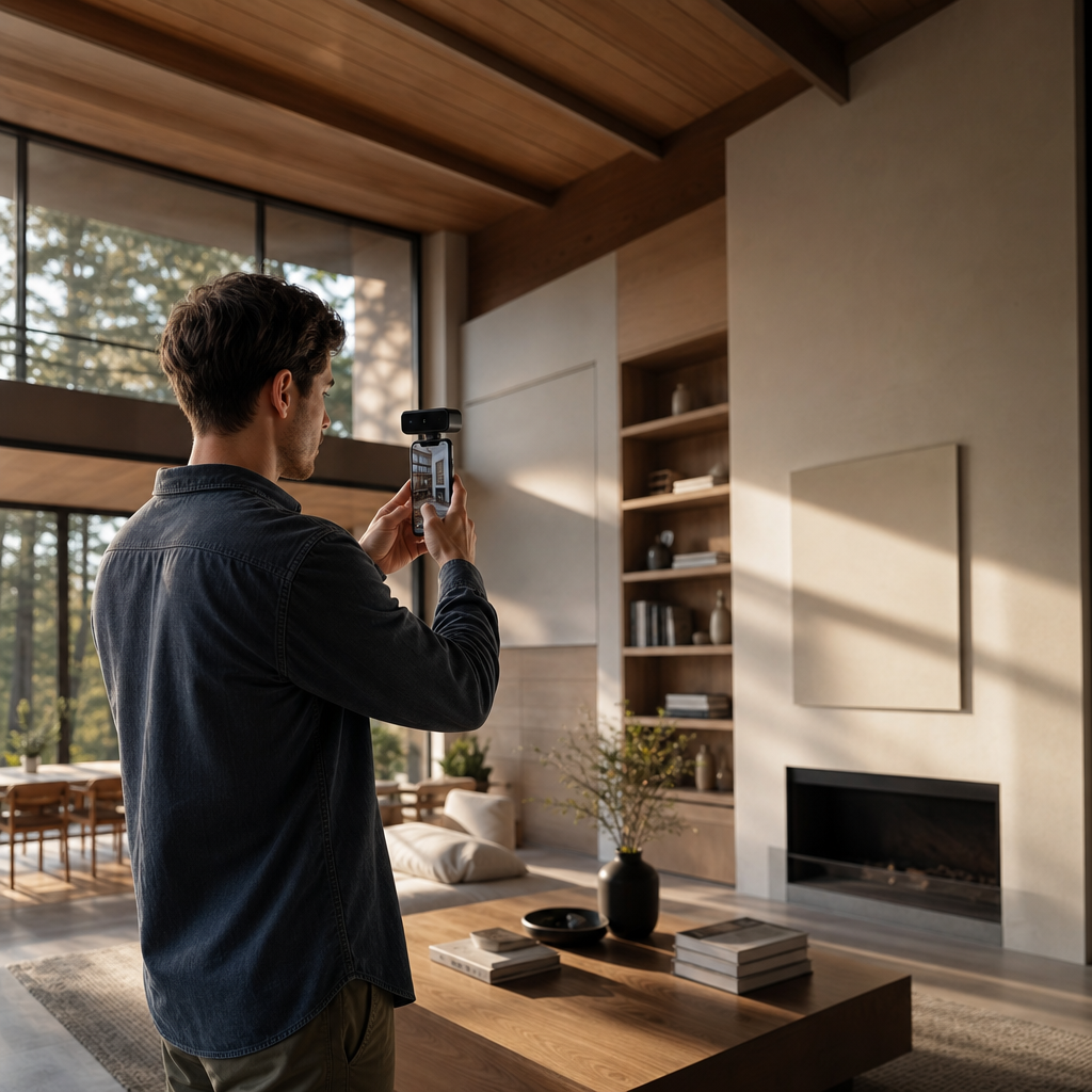
A lidar scanner iphone turns a Pro-class iPhone into a compact 3D measurement instrument: the rear LiDAR sensor fires infrared pulses, measures how long each reflection takes to return, and fuses those millions of distance readings with camera motion to reconstruct a textured mesh or point cloud of a space or object. With Voxelio, that same depth pipeline is packaged into capture modes tuned for real work — from as-built documentation to product models to camera-pose data for research pipelines — and everything runs on the phone with no cloud round-trip.
The practical question is not whether your iPhone can "do 3D." It is what kind of 3D data you need, whether your device even has the sensor, and where a phone genuinely competes with a tripod-mounted laser scanner. This guide walks through the mechanism, the capture options, and the decision criteria so you can judge fit before you scan.
Table of contents
What "using a lidar scanner iphone" actually means
When someone says they use their iPhone as a LiDAR scanner, they are choosing to treat the phone as a depth-measuring instrument rather than a camera. That choice has three moving parts.
First, you rely on the rear LiDAR module as your depth source. That sensor exists only on Pro and Pro Max models from iPhone 12 onward, plus recent iPad Pros — not on standard or Plus iPhones. Second, you use a LiDAR-aware app that talks to Apple's ARKit to convert raw depth into rooms, objects, and camera trajectories you can export. Third, you decide what output you actually need: a watertight textured mesh, a dense point cloud, or camera poses and video for downstream reconstruction.
That last decision is where audiences diverge. For architects, interior designers, and real-estate professionals, the live question is whether phone LiDAR is accurate and stable enough for site documentation and floor-plan work. For engineers, makers, and 3D-printing enthusiasts, it is whether mesh and point-cloud quality can stand in for a dedicated scanner when reverse-engineering parts. For e-commerce sellers, it is about replacing flat photos with interactive USDZ models that load in AR. For CV and robotics researchers, it is whether on-device pose and depth slot into NeRF, SLAM, or photogrammetry pipelines without a cloud dependency. The mechanism is identical across all of them; only the export target changes.
If you are still deciding whether a phone-based scanner belongs in your toolkit at all, our beginner's guide to 3D scanners frames the wider category before you commit to a device.
How iPhone LiDAR captures 3D
At the hardware level, LiDAR — Light Detection and Ranging — measures distance by emitting infrared light and timing how long the reflection takes to return. The iPhone's rear module projects a pattern of infrared pulses and reads the time-of-flight to each point, building a depth map of the scene several times per second.
A single depth map is only a snapshot. Real 3D capture happens when ARKit stitches those snapshots together through four coordinated stages.
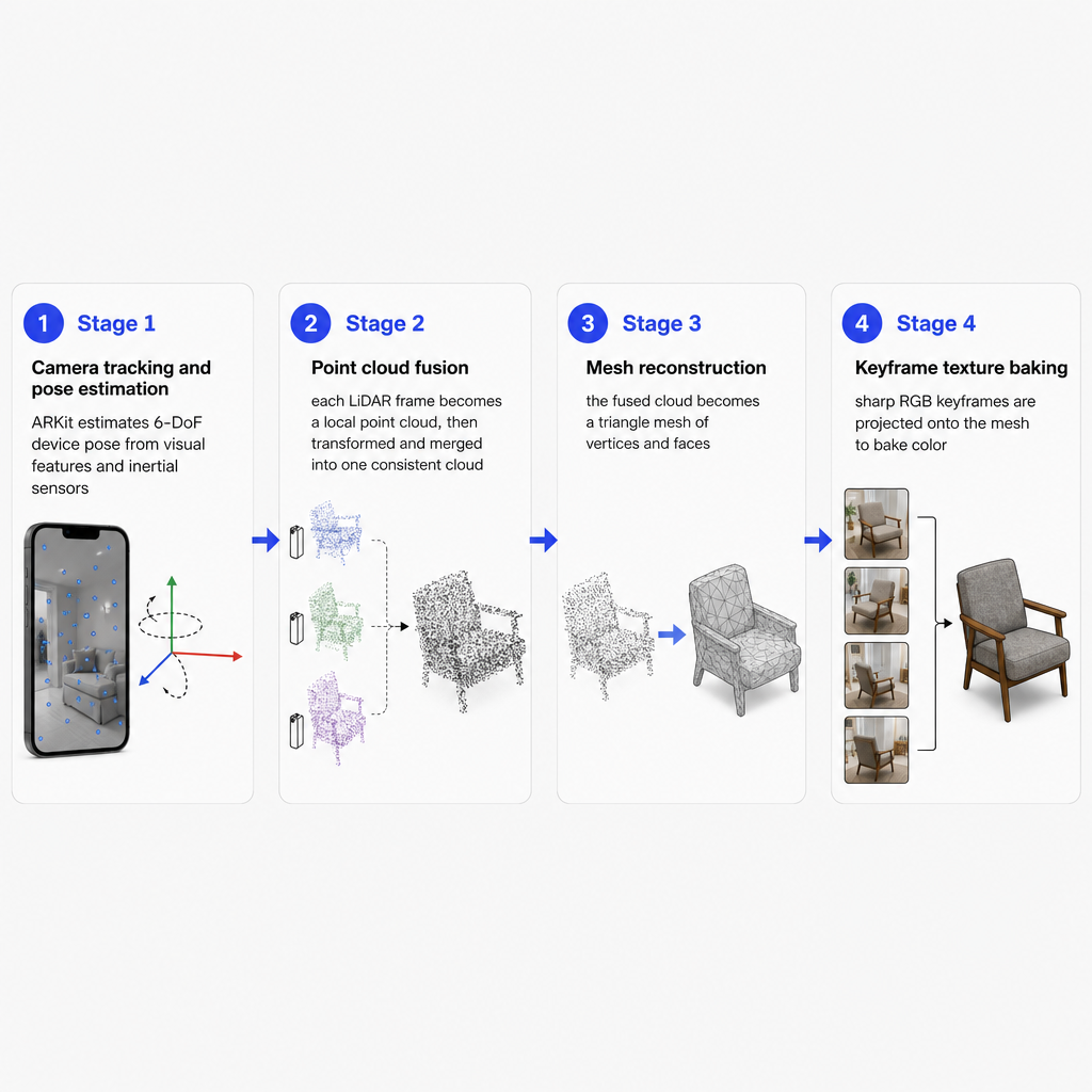
Camera tracking and pose estimation. As you move the phone, ARKit estimates its 6-DoF pose — position and orientation — relative to the environment using visual features and inertial sensors. That produces a continuous trajectory of the device through space, which every later stage depends on.
Point cloud fusion. Each LiDAR frame becomes a local point cloud: 3D points with coordinates relative to the current camera pose. ARKit and LiDAR-aware apps then transform and merge those small clouds into one spatially consistent cloud, aligning overlapping regions and rejecting outliers. This spatial fusion is why sweeping around a room yields a coherent model instead of disconnected patches.
Mesh reconstruction. The fused cloud is turned into a surface — a triangle mesh of interconnected vertices and faces that approximates walls, furniture, and object surfaces. ARKit exposes a real-time environment mesh, and Voxelio builds on it, refines it, and exports it as OBJ and USDZ.
Texture and color baking. The RGB camera captures images throughout the scan. The app selects keyframes with good coverage, lighting, and sharpness, then projects those images onto the reconstructed mesh or point cloud. This keyframe texture baking preserves both geometry and appearance, giving you textured meshes and colored point clouds rather than bare geometry.
The defining trait of this pipeline is that every stage — depth, tracking, fusion, meshing, texturing — runs on the device. There is no upload, which keeps latency low and sensitive site or product data local.
Capture options inside Voxelio
Voxelio is built on the LiDAR and ARKit pipeline, but we split it into distinct capture modes so each profession gets exactly the data it needs without carrying the overhead of the rest.
Mesh mode leans on ARKit's live environment mesh and refines it into textured OBJ/USDZ files. It is the natural choice when you need visually faithful room or object models that open cleanly in CAD viewers, DCC tools, or AR.
Point Cloud mode focuses on spatial fusion and exports colored PLY point clouds. Engineers and makers often prefer clouds because they feed directly into scan-to-CAD, inspection, and simulation work; for CV researchers, a clean cloud is a straightforward input for registration and reconstruction algorithms.
Pose + Video mode records HEVC video alongside frame-accurate camera pose data. This turns the iPhone into a calibrated video rig for NeRF, SLAM, or photogrammetry: you get the image stream and the motion trajectory aligned to one timeline and coordinate frame, with no external trackers.
MultiCam mode extends capture across multiple viewpoints or sessions while still using ARKit and LiDAR for spatial alignment. It earns its place in larger interiors, complex objects, or research scenes where a single pass would leave occlusions.
Across all four, the emphasis is on-device processing, centimeter-scale spatial precision, and exports — OBJ, USDZ, PLY, video plus poses — that plug into existing tools without custom middleware. If you want a hands-on walkthrough of a single object capture, see how to 3D scan an object with your iPhone.
When an iPhone LiDAR scanner is the right tool
Choosing a phone over a dedicated laser scanner comes down to a handful of practical criteria.
Device compatibility. LiDAR is not on every iPhone. It is limited to Pro and Pro Max models from iPhone 12 onward, plus certain iPad Pro models from 2020. On a non-Pro iPhone you are working with photogrammetry only; Voxelio's LiDAR modes require a LiDAR-equipped device.
Required accuracy. For many architecture, interior, and real-estate workflows, phone LiDAR offers enough precision to document rooms, capture furniture, and derive approximate measurements or context models. Scan-to-CAD work demanding millimeter tolerance across large industrial spaces may still favor tripod-mounted scanners, but for small interiors, residential as-builts, and fabrication references, centimeter-scale precision is often acceptable. Engineers should size this against the smallest feature they care about: phone LiDAR is strongest on overall geometry, while very fine edges, small fillets, or micro-features may need closer-range capture or a complementary tool.
Target output. Match the mode to the first application you open after scanning. Need textured meshes for AR or visualization? Mesh mode and OBJ/USDZ fit Apple's ecosystem and common DCC tools. Need point clouds for CAD, inspection, or algorithm development? Point Cloud mode's colored PLY integrates with engineering and CV software. Need pose-aligned video for NeRF or SLAM? Pose + Video mode delivers trajectory and frames from one device.
Scene and materials. LiDAR performs best with clear structure, moderate distances, and surfaces that reflect infrared reliably. Highly reflective, transparent, or very dark materials degrade depth quality and force the fusion and filtering to work harder. Large, featureless open areas challenge camera tracking, while cluttered interiors tend to give more stable tracking. Medium-scale rooms, furniture, and products in ordinary indoor light are the sweet spot; sun-drenched outdoor sites and glass-and-mirror scenes may call for a specialized setup.
Speed and access. An iPhone is already in your pocket, which matters for quick as-builts, on-site documentation, or a one-off object. With on-device processing and no subscription requirement, capture stays local: install, scan, export, and move the data into your tools without cloud accounts or hardware cases. When minimizing friction is the priority, a phone with Voxelio is frequently the most practical option.
Risks and limitations worth planning around
No capture pipeline is risk-free, and knowing the failure modes helps you scan around them.
Range and resolution. The iPhone's LiDAR is tuned for AR and autofocus, not for surveying a factory floor from tens of meters away. Practical scanning ranges are short to medium, and fine features at longer distances become unreliable.
Tracking drift. ARKit depends on visual features and inertial sensors. Long featureless walls, fast motion, or abrupt turns can introduce drift in pose estimates. Fusion compensates, but smooth, overlapping passes without sudden jumps produce noticeably cleaner results.
Difficult surfaces. Shiny, transparent, or very black surfaces can return noisy or incomplete depth, leaving holes or artifacts in meshes and clouds. This is a general LiDAR trait, not specific to the iPhone.
Dynamic scenes. LiDAR and ARKit assume a mostly static environment. Moving people, pets, or machinery can create ghost geometry or inconsistent fusion, which matters in high-traffic interiors.
Data volume. Dense clouds, detailed meshes, and long Pose + Video sessions produce large files that press against storage and memory. On-device processing helps with privacy and speed but leaves storage and export discipline to you.
For the audiences this app serves, these risks stay manageable when you scan at moderate ranges, in typical indoor conditions, with deliberate coverage.
What this looks like across professions
The underlying mechanism is constant; the mode and export change with the goal.
In architecture and interiors, capture a residential room in Mesh mode, export a textured OBJ/USDZ, and drop it into a BIM or visualization pipeline as a reference for layout and furnishings. In engineering and fabrication, scan a small mechanical assembly in Point Cloud mode, export a colored PLY, and use scan-to-CAD tools to derive reference surfaces or check clearances before you build.
For e-commerce, scan a product on a neutral background in Mesh mode, generate a textured USDZ, and place it on an AR product page so customers can view the item at home. In CV and robotics research, use Pose + Video mode to capture calibrated sequences for NeRF training or SLAM benchmarking without external trackers. And for DIY and 3D printing, capture household objects or furniture as fabrication references, then use the clouds or meshes as guides for custom adapters, enclosures, or replicas.
If you are comparing tools before committing, our roundup of free 3D scanner apps for iPhone sets the landscape in context. The right next step is to pick the output your downstream tool expects, then choose the matching mode — and if your workflow is unusual, tell us the export format and precision you need so we can point you to the right mode.
Frequently asked questions
Which iPhones actually have a LiDAR scanner?
LiDAR is available on iPhone 12 Pro and Pro Max and every later Pro and Pro Max model, plus iPad Pro 11-inch (2nd generation and later) and 12.9-inch (4th generation and later). Standard and Plus iPhones do not include the sensor.
Do I need a Pro model to use Voxelio's LiDAR features?
Yes. Our LiDAR-based modes require a device with a LiDAR sensor, which currently means Pro-class iPhones and recent iPad Pros.
How accurate is iPhone LiDAR for room scans and as-builts?
For small to medium interiors, it provides enough precision for context models, rough measurements, and visualization, with results improving on later Pro generations. High-precision industrial surveying still favors dedicated laser scanners.
What files can Voxelio export from LiDAR scans?
We export textured meshes in OBJ/USDZ, colored PLY point clouds, and HEVC video with frame-accurate camera poses — all processed on the device.
Is cloud processing or a subscription required?
No. We process meshes, point clouds, and camera data on-device, and the app is a free download with no subscription requirement.